Showing posts with label geography. Show all posts

Thursday, 29 September 2011

Truth or Lie: Activity for any classroom

Chiew on iasku Blog Challenge truth or lie

I recently responded to a blog challenge by a video recording of myself - you can see it by clicking here. Most EFL teachers are probably aware of the activity where students are asked to say some things about themselves, and the others are to guess if they're true or false.

I suggested taking this a step further and have the students bring video recordings of themselves saying those things.

But, you can take it yet another step further. Although this activity is popular in the EFL classroom, there's no reason why it can't be used in the other classes, too. The topic doesn't need to be personal; it could be on anything. Examples:
  • What is a tangent, or an apex? (Geometry/Art)
  • They could describe an animal or an ecosystem. (Science)
  • They could talk about the rules of rugby. (PE)
  • They could talk about countries, or climate. (Geography)
As you can see, the limit is the extent of your imagination! Try it and let us know!

Thursday, 14 April 2011

Second Conditional Activities: Comparing Countries

We have already seen an activity for second conditional with Norah Jones, and I'd also touched on the subject of countries prior to this. However, from my experience, the concept of conditionals isn't too hard to grasp, but it could be used as a springboard for speaking activities. Please see my post on The Best Countries as well.

With that in mind, I introduce to you this interesting website, If It Were My Home. I'll have to admit that I first heard of it from Nik Peachey. Andy Lintner and Annette Calabrese first started the page in 2010 to highlight the magnitude of the BP Oil Spill disaster, but have since expanded it to include interesting information on many countries.

If you click on 'Country Comparison', if I remember correctly, it will ask you permission to access your IP address to know where your home country is. This happens only once. If you do this, it will assume you wish to compare your home country with another. Click on another name further down the page.

ELT ESL EFL TEFL CLIL Resources, Games, Activities: second conditional, countries

When you've done that, something like this will be what you get:

ELT ESL EFL TEFL CLIL Resources, Games, Activities: second conditional, countries

Here, we're comparing Spain to Australia. On the map, you can see the difference in size of the two countries. It also lists a few comparisons between the them, e.g.

  "If Australia were your home instead of Spain, you would have 68.51% more chance of being employed."

If you wish to compare your home country (Spain) to a different country, select another from the drop-down list by clicking on the arrowhead, then on 'compare'. However, if you want to compare the chosen country (Australia) to another, you select the following button, where it says 'Compare (Australia) to other countries'. When you click this, a list of countries will be displayed. Select one.

In this way, you can compare any two countries you wish. Below, you can see a comparison between the two most digital countries in the world, according to a recent survey.

ELT ESL EFL TEFL CLIL Resources, Games, Activities: second conditional, countries

Notice that the statistics are highlighted in three different colours. Red is negative (e.g. ...you would consume 5.1 times more oil), green is positive (e.g. ...have 87.74% more chance of being employed), and blue is for babies! At least I haven't seen any other statistics highlighted in blue.

ELT ESL EFL TEFL CLIL Resources, Games, Activities: second conditional, countries

If you want to see additional information on a particular statistic, just click on the arrowhead to its right, and more information will appear.

ELT ESL EFL TEFL CLIL Resources, Games, Activities: second conditional, countries

Further down, you'll see a thumbs up and a thumbs down sign. These are for you to vote. Below this, you'll see more information on the country you're comparing to.

If you scroll even further below, you are allowed to enter your comments, and read those of others (if there are any) of the compared country.

So, as you can see, there's ample material for students to come up with second conditional sentences. Conversation shouldn't be restricted to this grammar structure; students should be encouraged to speak about any of the statistics they see or even the comments. For more ways of using the site, I'd recommend your reading Nik's post.

Related posts:

Sunday, 9 January 2011

Countries & Nationalities - Another Game

A Guide to Countries of the World (Oxford Paperback Reference)
Here's another game on countries and nationalities. The clue gives you the nationality and you'll have to find the country on the map.


You may also like these other games on countries:

Countries and Nationalities Arcade Game
The Best Countries
Flags of the World
Capitals of the World
Find these Cities

Chiew's CLIL EFL ESL ELL TEFL: Countries and Nationalities

Thursday, 2 December 2010

The World's Best Countries: Games and Activities

If you had a choice of a country to live in, where would you choose? What would your criteria be?

Newsweek recently compiled a list of the best countries in the world based on health, economy, politics and the quality of life. The project took them several months to complete, but their results are now available. Click on the image below to browse the scores and rank of the country of your choice, interactively.

Chiew's ELL EFL ESL CLIL Online Games, Resources, Activities: World's Best Countries

Do you agree with the list?

This topic provides endless possibilities for classwork. You can have debates, web quests, conversations on food, culture, weather, etc., work on grammar points such as conditionals, and so on.

Below, I provide you with two point-and-click games: the first is on the geographical locations of the best 20 countries, and the second is one on their flags.

If you have any interesting ideas on how you can use this topic for your class, why don't you share it here with  others?

Chiew's ELL EFL ESL CLIL Online Games, Resources, Activities: World's Best Countries

Chiew's ELL EFL ESL CLIL Online Games, Resources, Activities: World's Best Countries


Get Chitika | Premium    Get Chitika eMiniMalls

You may also like these:
Flags of the World
Capitals of the World
Latitude & Longitude, explained
Places on Earth Quiz
Find these Cities
Countries & Nationalities


Wednesday, 17 November 2010

Flags of the World Online Game


Chiew's ESL EFL CLIL Online Games Juegos Activities Actividades: World Flags

Try to identify all these flags in this point-and-click game. For those who aren't familiar or who still don't know, these games which I created in Purpose Games aren't too difficult. The trick is to click on any dot if you don't know the answer. On the 3rd wrong attempt, notice how one spot will change its colour from blue to purple. Try to remember it for the next time you try. Obviously, you'll need to play the game several times in order to be able to learn something. Always aim for 100%, and always aim for as quick a time as you can achieve. Oh, and please register - it's free. By registering, your scores will be saved and displayed. Make sure to try these other games, too:


For more, browse under category 'geography' in the GAMES AND QUIZZES section.

Monday, 3 May 2010

The Earth: Rocks and Minerals

19 May 2010: This has to be amended ... Chiew


Teachers, please take note: some of my quizzes, like this one, for example, ask for an email. If an email is provided, the results will be sent automatically to it. This allows you to grade/check your students' progress. If you haven't got an email for this purpose, I'd suggest creating one for this purpose, and ask the students to provide that email in the quiz.


Click on image to begin 100-piece Grand Canyon Jigsaw Puzzle

Thursday, 8 April 2010

Culture Studies for 9-11 yr old kids

I wish I was a kid with all this technology creeping into the classroom...
A commendable project for 9-11 year-old kids has been started by Mrs Kim Sivick where her students are interested in hearing from people from all over the world.

So, if you're reading this, whether you're a student, a teacher, or neither, I'm sure they would appreciate hearing some comments from you.

Wednesday, 24 March 2010

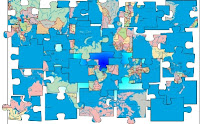
Capitals of the World Online Quiz & Jigsaw Puzzles

Wiki map of the world

Identify which country these 20 capitals belong to. Feedback is, as always, much appreciated. Click to begin!

My recent crossword puzzles have been rather popular, so here are some more!

online jigsaw puzzle 30-piece beginners jigsaw puzzle

60-piece intermediate jigsaw puzzle

140-piece advanced jigsw puzzle

Saturday, 6 February 2010

What is an ecosystem?

Chiew's ESL EFL CLIL Games Juegos Activities Actividades blog: ecosystem


An ecosystem is a community of all plants and animals in a particular area, and the way they depend on each other, either directly or indirectly. It includes plants, trees, animals, microorganisms, water, soil, and people.

Everything that lives in an ecosystem is dependent on the other elements that are also part of that system. If one part of an ecosystem disappears or is damaged, it has an impact on everything else.

Ecosystems can be as large as a tropical rainforest or a desert, or as small as a pond or a hedgerow.

Examples of ecosystems are coral reefs, rainforests, deep seas, savanna, tundra, and even urban centres such as our cities.

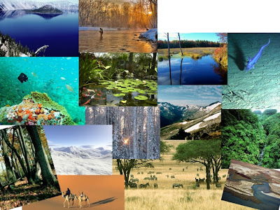
Now, see if you can identify the ecosystems featured in this labelling game. If you think you are quite familiar with the concept of ecosystems, you can try the second quiz at the bottom. Don't forget to post a comment!

Click on the image below to start the labelling game.

Chiew's blog: ESL EFL CLIL Games Juegos Activities Actividades for Education, 游戏学英语


Thursday, 24 December 2009

Quiz: Find the coordinates of these places; Latitude & Longitude Explained


To help us navigate around the Earth, we draw imaginary lines around it. First, we divide it into two parts. Through the middle, splitting the globe into two hemispheres, is the Equator. The half above the Equator is known as the Northern Hemisphere, and the lower half is known as the Southern Hemisphere.

Then, we draw lines parallel to the Equator. These, we call latitudes. The latitude of a place basically tells us how far a place is from the Equator. We express it as degrees north or degrees south. The equator, therefore, has zero latitude (0º). The North Pole is at 90ºN, and the South is at 90ºS.

We now draw lines from the North Pole to the South Pole. These lines are not parallel; instead, they meet at the two poles. We call these lines longitudes. As with latitudes, we need to express them in relative to something else, so a line passing to the Royal Observatory, Greenwich (near London) was chosen as the zero-longitude reference line.

Places to the east of this line are in the eastern hemisphere, and places to the west are in the western hemisphere. The maximum longitude is 180ºE or 180ºW. This is actually the same line.

Using the latitude and longitude (we call them coordinates), we can locate any point on earth. Two of the most extreme points on earth are Attu Island, in Alaska, at 52ºN 172ºE, and Caroline Island, in the Pacific Ocean, at 9ºS 150ºW.

Now, using the map below (or use an atlas), try the quiz. Click on the map for a larger image.


Thursday, 3 December 2009

Places on Earth Quiz

How well do you know your own planet, Earth? Test your geography knowledge with this fun quiz. Thanks goes to The Smithsonian and NASA for the images of Earth as seen from Space.

Sunday, 29 November 2009

Places in the World: Decoding Word Game

From the clues at the bottom of the document, guess these famous landmarks in the world. To help you further, coded words are given for each place, and a decoder is also provided at the top of the document.
Have fun learning!
Decoding Places in the World

Tuesday, 17 November 2009

Why do we have seasons on Earth? (Geography/Science)

It is perhaps something we all have taken for granted, and perhaps some of us think it has got something to do with the distance of the sun from the Earth at different times of the year.

Well, actually, the reason why we have seasons is because the Earth is tilted. What this basically means is this: imagine a stick stuck right through the Earth from the North Pole to the South Pole, and another through the Sun. This is called the axis. If you put the Earth beside the Sun, these two sticks are not parallel. As it revolves around the Sun, the Earth's stick is at an angle of 23.5º to that of the Sun.

Why is the Earth tilted? When our solar system was formed about 5 billion years ago, there were lots of collisions between large celestial bodies. Due to these collisions, all the planets tilt at different angles.

If the Earth's axis were parallel to the Sun and not tilted, the Sun would remain exactly halfway between the North and South Poles, and there would be no seasons on Earth. Each area on Earth would have the same relative climate and the same amount of daylight throughout the entire year.

These images from NASA demonstrate this tilt:


This excellent video below explains how the Earth's seasons are a result of its tilt. Even though the narrator speaks very clearly and quite slowly, some of you may have difficulty understanding everything, so I have transcribed it. Try to understand the explanation just by watching the video first. Then, follow the transcript while playing the video again.


Transcript:

The axis of the Earth is an imaginary line on which the Earth rotates. It links up the two poles. Both the axis and the Earth are tilted at an angle of twenty-three and a half degrees during a revolution.

The tilting of the axis results in direct sunlight falling on different places during different seasons. This causes variations in the duration of days, nights and seasons.

Relationship between the location of the overhead sun and the seasons

Similarly, the revolution of the Earth and the tilting of the axis result in different angles of the sun during different periods. When the sun is directly overhead, we call this the overhead sun. At this time the Earth's surface and the midday sun form a ninety-degree angle. Different locations of the overhead sun results in variations in the amount of solar radiation received in different areas and at different periods.

Spring Equinox

On 21st or 22nd March, the overhead sun is over the equator. The equator receives the largest amount of solar radiation. At this time, the northern hemisphere is in the spring equinox while the southern hemisphere is in the autumn equinox. The angle of the sun decreases towards the poles. On this day, the two hemispheres receive a similar amount of solar radiation, and the length of day and night is the same at all places on the Earth.

After this day, it is spring in the northern hemisphere where the day is longer than the night. In the southern hemisphere, it becomes autumn, when the day is shorter than the night.

Summer Solstice

On 21st or 22nd June, the overhead sun is over the Tropic of Cancer. It receives the largest amount of solar radiation. At this time, the northern hemisphere is in the summer solstice while the southern hemisphere is in the winter solstice. The angle of the sun decreases towards the poles. On this day, the length of daytime of the northern hemisphere is the longest in the year while that of the southern hemisphere is the shortest in the year.

Besides, there are twenty-four hours of daylight at the Arctic Circle and twenty-four hours of darkness at the Antarctic Circle.

Autumn Equinox

On 22nd or 23rd September, the overhead sun is over the equator again. The equator receives the largest amount of solar radiation. On this day, the northern hemisphere is in the autumn equinox while the southern hemisphere is in the spring equinox. The angle of the sun decreases towards the poles. On this day, the two hemispheres receive a similar amount of solar radiation, and the length of day and night is the same at all places on the Earth.

After this day, it is autumn in the northern hemisphere where the day is shorter than the night. In the southern hemisphere, it becomes spring, when the day is longer than the night.

Winter Solstice

On 21st and 22nd December, the overhead sun is over the Tropic of Capricorn. It receives the largest amount of solar radiation. On this day, the northern hemisphere is in the winter solstice while the southern hemisphere is in the summer solstice. The angle of the sun decreases towards the poles.

On this day, the length of daytime in the northern hemisphere is the shortest in the year while that of the southern hemisphere is the longest in the year.

There are twenty-four hours of darkness at the Arctic Circle and twenty-four hours of daylight at the Antarctic Circle. (Note that at this point in the video (5:38), the Poles are labelled the wrong way around).

Now, explore space with this excellent interactive explanation from BBC Bitesize.
It too explains, among other things, how seasons and the phases of the moon are formed. For a more detailed explanation of the phases of the moon, click here. As with the previous video, try watching it without the aid of my transcript first. Then, while following my transcript, listen to it again. At the end of the video, there is an interactive quiz.

Games for Education, 游戏学英语
Transcript:

When you're ready for space exploration, press start.

The Universe contains billions and billions of galaxies, and this one, called The Milky Way, contains 300 billion stars. Sounds a lot, but it's kind of average for a galaxy. One of those 300 billion stars is our Sun; yes, the one you see in the sky in the daytime.

Eight planets move in orbit around the Sun. Click on the one that you're sitting on.

Yea, that's planet Earth. Moving out from the Sun, we pass Mercury, Venus, Earth, Mars, Jupiter, Saturn, Uranus and Neptune. All these planets are kept in orbit by powerful gravitational forces, otherwise, they'd just fly off into space.

Here is tiny Pluto; it used to be considered the ninth planet in our solar system, but in 2006, scientists decided it was too small. Now, it's known as the dwarf planet instead.

This is the Earth seen from space. As the planets move along, they spin around, too. Let's take a look from above the North Pole. From here you can see the Earth spinning anti-clockwise. Each rotation takes 24 hours, which is why each day is 24 hours long.

When you're on the light side, the side lit by the Sun, it's daytime, and when you're on the dark side, it's night. Looking at the Earth from the side now, we can see that it spins towards the East. See Britain down there, it's about to move from the shadow into light; that's from night into day. Let's look at it in a different way.

So, we're on the ground, in the dark, looking South, and waiting for the sunrise as our part of the planet moves into light.

Click where you think the Sun will appear.

Well done!

That's spot on. Because we're spinning towards the East, the Sun first appears in the Eastern sky. It's the same at night with the moon and the stars - they seem to move from East to West as the Earth spins, but don't forget that as well as spinning, we're also moving through space. It takes 365 days for the Earth to go once all the way around the Sun, and that is why a year is 365 days long, except when it is a leap year. Because the Earth takes slightly more than 365 days to orbit the Sun, we need to make a correction to the calendar. So, every four years we add an extra day to February. If you are born on Feb 29th, it's a four-year wait between birthdays.

Another thing about our planet is that it's a little bit wonky. Earth's axis, that's the line from the North Pole to the South Pole, is tilted. That gives us the seasons. How? Let's see.

Watch what happens as the Earth orbits the Sun. The UK is in the northern half of the northern hemisphere of Earth. When our half of the planet is tilted towards the Sun, it feels warmer. Days are longer and nights are shorter. People wear less - it's summertime!

Six months later, we're on the other side of the Sun, and now we're tilted away from it. Days are shorter and nights are longer. You're in your warm clothes - and it's winter! Brrr!

Here's a question. When it's winter in the UK, where on Earth is it summer?

Exactly! In Australia, they have summer in December - Christmas dinner on the beach, anyone?

We've seen that the Earth orbits the Sun. Ok, but we also have our very own satellite orbiting Earth: the Moon. The Moon is made of rock, and unlike the stars, it can't produce any light of its own. All that silvery moonlight is just reflected from the Sun. The Moon orbits the Earth, held neatly in place by gravity and it takes 28 days to go around once. You can see here how, sometimes, the Moon is in the same part of the sky as the Sun, and sometimes it's on the opposite side, and sometimes, it's halfway between.

That's why when you look up at the Moon, it looks different day by day. We call these different appearances the phases of the Moon, like the full Moon and the new Moon.

Pull the Moon around its orbit to watch it change phase.

Once in every 28 days, you can't see the Moon at all. Many people think that's because the Earth is shading the Moon, but that's not right. You can see here that's because the Moon has a shadow side facing the Earth - this is known as the New Moon. Of course, the Moon isn't the only satellite orbiting the Earth. There are thousands of human-made satellites in orbit, too. They're shot up there by rockets to do many different things: observe weather patterns, send TV and communication signals, or just to spy on other countries.

Other satellites collect information about space itself like space telescopes. Scientists use them to study things we can see in space but can't yet travel to, things in our solar system, our galaxy, and the furthest regions of deep space.

Ready for a recap?

1. Gravitational forces keep planets in orbit around the Sun and satellites in orbit around planets.

2. The Earth takes 24 hours (1 day) to complete one rotation on its axis. The Earth takes 1 year to orbit once around the sun.

3. The Earth spins at a slight angle on its orbital path. Its tilt towards or away from the Sun is what gives us seasons.

4- The Moon takes 28 days to orbit the Earth. During this time we see different phases of the Moon.

Ok, I think that's all for now. Time for a test!

Friday, 13 November 2009

Plain Massif - Know Your Relief (Geography)

I'm sure you know what a beach is, but can you tell a cliff from a cape, or a gorge from a glacier? Put yourself to the test and try to match the descriptions to the images by clicking on the icon below.

Speed (time) and accuracy (percentage of correct answers) are the two important factors here. Before you start the game, try to identify what the images are first. After you've played the game, don't forget to post your name (full name or at least your first name and the initials of your surname, your school, your class, and your scores - the % and the time) in the comments section below.

Chiew's blog: Games for Education, 游戏学英语

If you like this or the other games in this blog, please link to it by copying and pasting this HTML code (click anywhere inside the box, click ctrl+A, then ctrl+C) into your own blog or web template. This is the badge you'll get:


Games for Education

Monday, 26 October 2009

Find these major cities in this latitude/longitude game

Test your map reading skills! Using the given latitude and longitude, try to find these major cities as quick as you can. When you've finished, take note of your score (% and time), and post it in the comments section below.

If you would like to bring it a step further, see if you can identify the cities, and post your answers as comments.

The game is hosted in purposegames.com You don't have to register to play it, but if you want to be ranked, then you must register.

To start the game, click on the image below.

Games for Education, 游戏学英语

If you like this game, please link to it by copying and pasting this HTML code (click anywhere inside the box, click ctrl+A, then ctrl+C) into your own blog or web template. This is the badge you'll get:
Games for Education

Monday, 5 October 2009

Countries and Nationality (Elementary) Arcade Game


Match the nationality to the country in this fun arcade game. Read the rules before you begin. See how fast you can go, and try to get to as high a level as you can! Don't forget to tell me your scores!


If you like this game, please link to it by copying and pasting this HTML code (click anywhere inside the box, click ctrl+A, then ctrl+C) into your own blog or web template. This is the badge you'll get:


Games for Education